Lyne and Easter Happrew Roman Forts
Uncovering the Tweed worked with the Trimontium Trust to support them in their research aiming to better understand the landscape of southern Scotland during the Roman period. These forts sit within a very busy archaeological landscape, with numerous prehistoric hillforts and defended settlements, as well as many more Roman sites. This highlights how significant this landscape was to past communities throughout the centuries, with so many settlements forming alongside the Tweed and its tributaries.
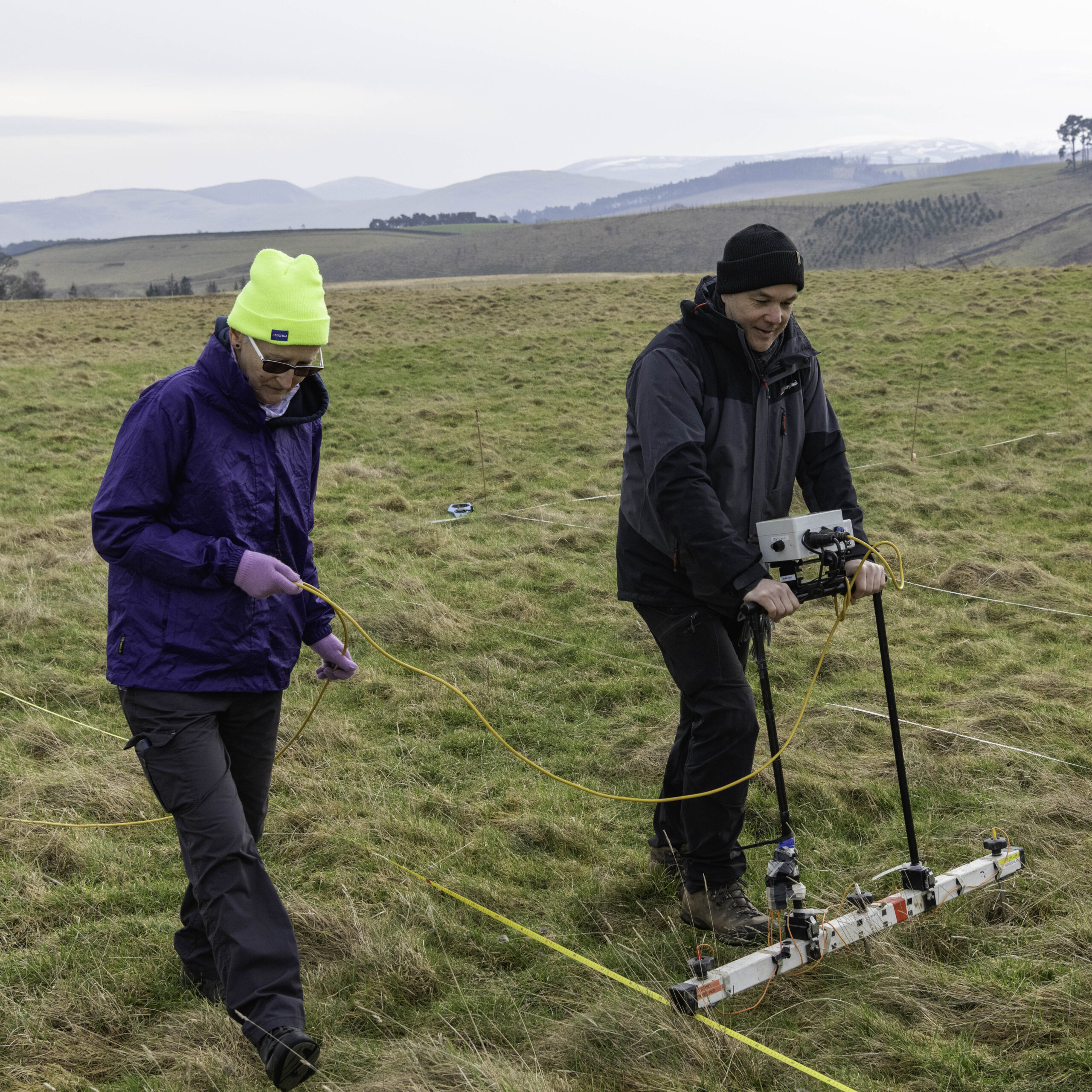
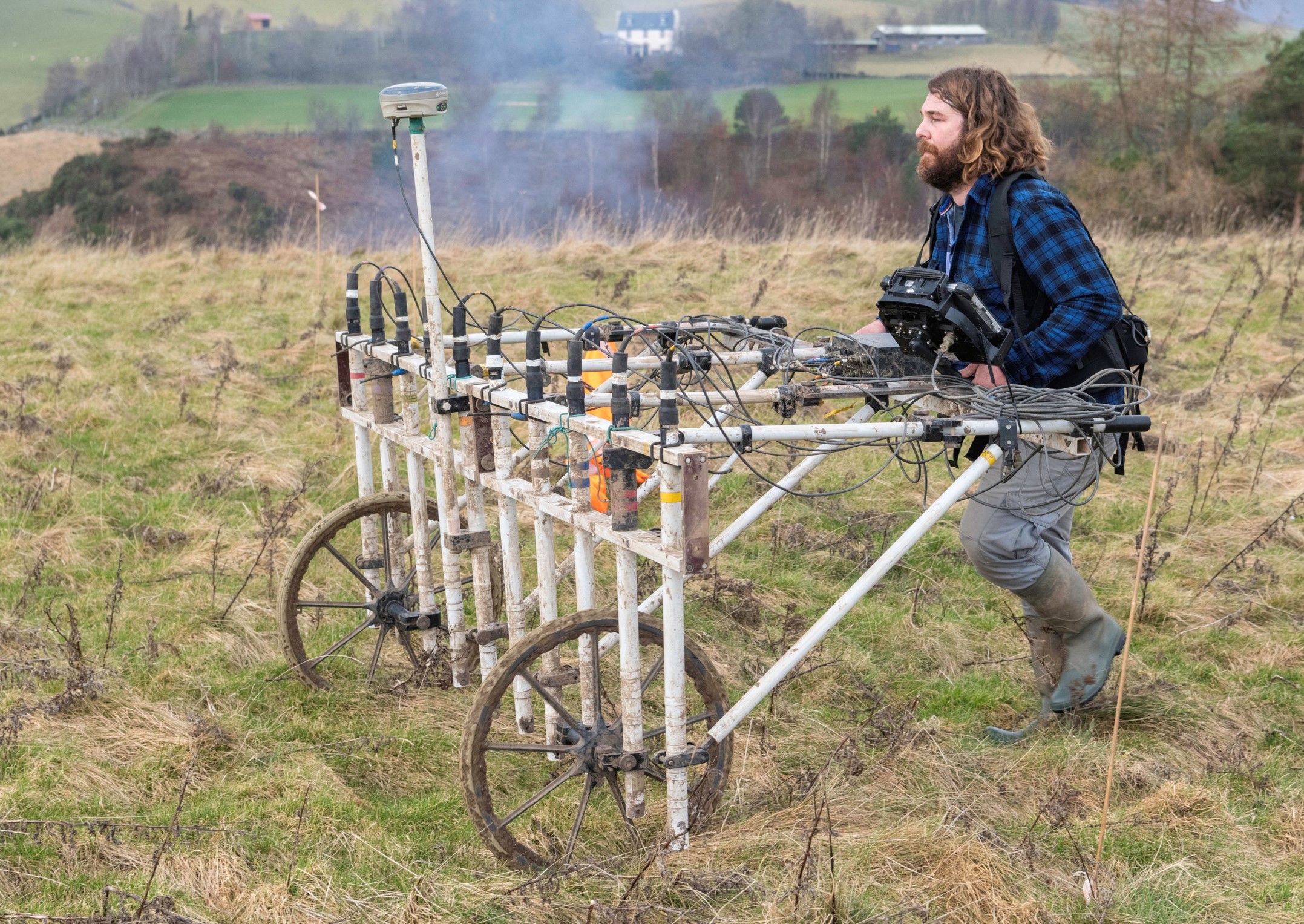
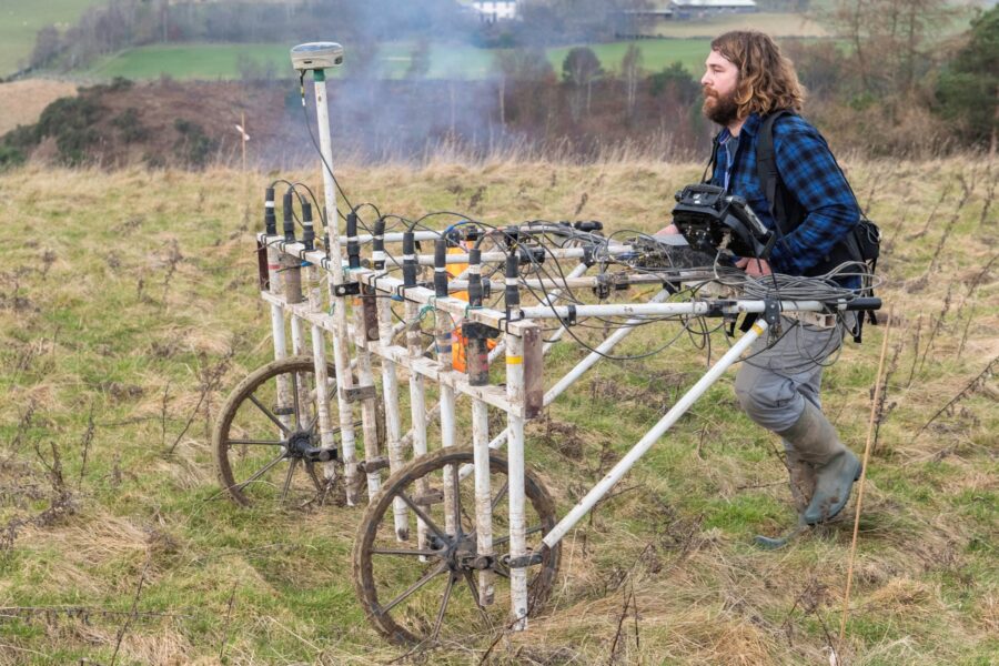
In early 2025, archaeologists and volunteers undertook geophysical surveys at two Roman forts on the Lyne Water, a short distance from where it flows into the Tweed: at Lyne, and Easter Happrew. The results of our work are summarised below, plus button links to download the full reports.
Many thanks to the landowners for allowing us to undertake these surveys, and to Historic Environment Scotland for granting the required consents to do geophysical survey at these scheduled sites.
Lyne
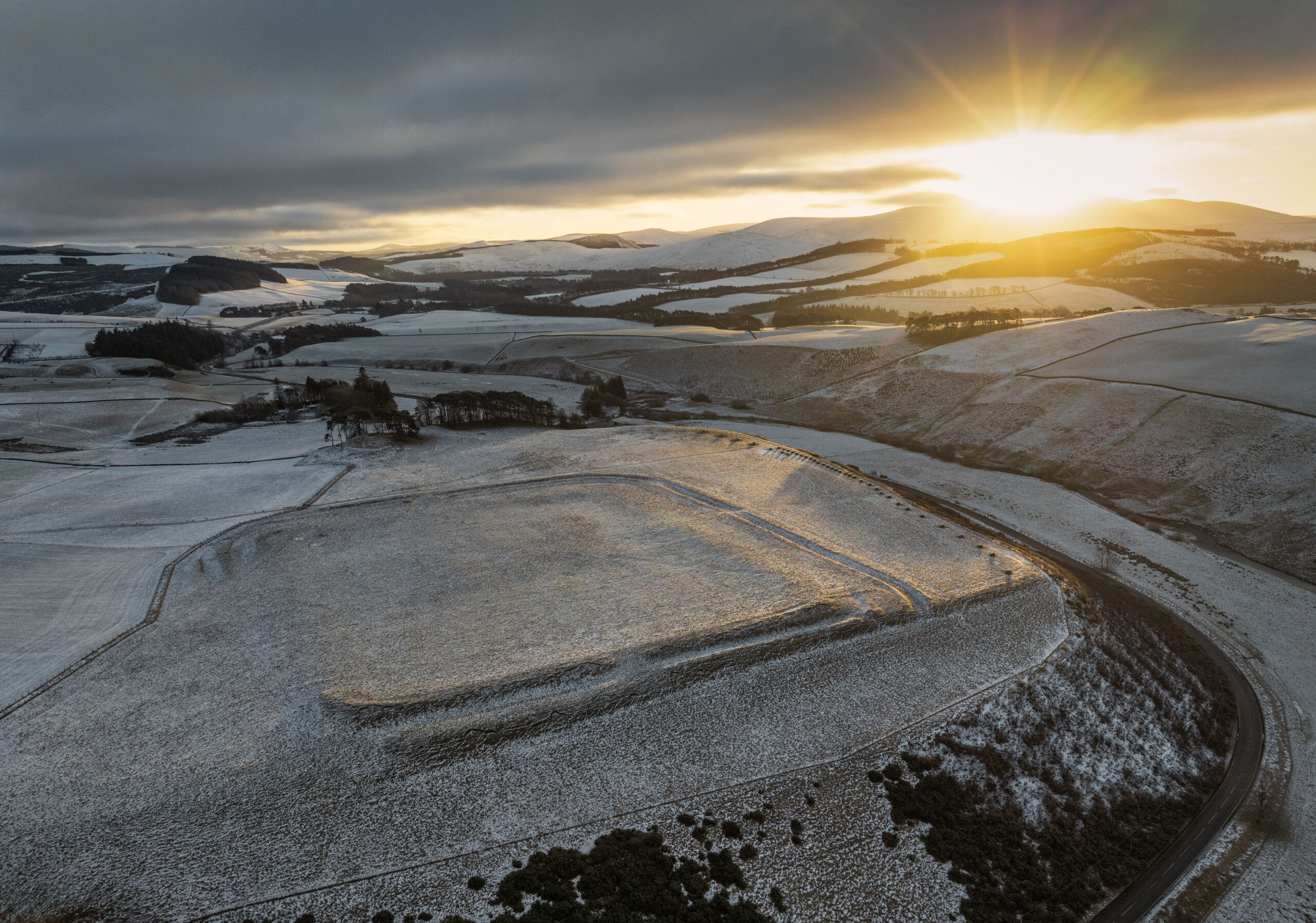
The fort at Lyne was first recorded at the end of the 17th century, and first excavated in 1901. The fort is defined by a large rampart built of turf and earth with a kerb of boulders, with one to three ditches along different edges of the fort forming additional defensive features. Within the fort buildings, including a principia, granary and commandants house, were identified built of red sandstone. It is likely that the fort at Lyne was built in the Antonine period (mid to late 2nd century AD) and only occupied for a short period of time.
Many of the anomalies identified in the geophysical survey data align with the plan of the fort created following the excavations in 1901, suggesting that preservation of the archaeological remains is good. In some areas, anomalies indicate the presence of features not previously identified, and others contradict the site plan presented after the 1901 excavations.
High resistance anomalies in the southwest quarter of the fort appear to align with previously depicted barracks, though the geophysical anomalies appear more numerous than the barracks depicted in plans of the fort, suggesting that there may be further structures present that were not previously identified. In the northwest quarter of the fort, anomalies appear to relate to features and buildings orientated east to west, which is perpendicular to the depiction of the buildings in this area in the 1901 plan of the fort. This does bring into question the degree to which this early plan of the fort was based on the results of the excavations, or hypothesized from other fort sites.
Four groupings of strong magnetic anomalies (m13) and areas of magnetic enhancement in the gradiometer data could relate to either small scale industrial or extraction activity just within the rampart of the fort which were not investigated/identified in the excavations adding new insight into the potential activities taking place in the fort.
Read AOC’s full report on geophysical survey at Lyne Fort
Further reading:
Christison D. (1901b) ‘Excavation of the Roman camp at Lyne, Peeblesshire, undertaken by the Society of Antiquaries of Scotland in 1901’, Proc Soc Antiq Scot 35 1900-1 Page(s): 154-86
Use the sliders below to compare the plans of the forts from previous excavations with the results of our geophysical surveys!
-
Before
After
Lyne Fort: plan from Christison's 1901 excavations, with AOC's interpretation plot of processed geophysical survey data.
Fortifications and Interior Foundations, Lyne Camp, by Mr Thomas Ross from Christison, Proc Soc Antiq Scot 35, p.169. Image © Thomas Ross, reproduced courtesy of the Society of Antiquaries of Scotland. -
Before
After
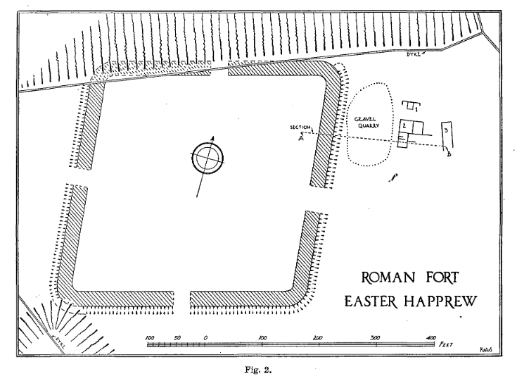
Easter Happrew Fort: plan from Steer's excavations in 1956, wiht AOC's interpretation plot of processed geophysical survey data.
Fig. 2 from Steer, Proc Soc Antiq Scot 90, p.96. Image © Kenneth Steer, reproduced courtesy of the Society of Antiquaries of Scotland.
Easter Happrew
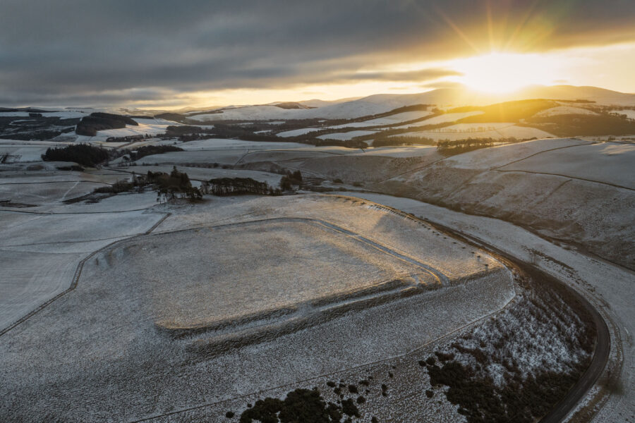
The fort at Easter Happrew was first identified in 1955 after the RAF took a series of aerial photographs of the fort already known at Lyne, and its surrounds, at the request of what was then the Ancient Monuments Commission. The photographs of the fort at Lyne apparently added little to the record, so the discovery of a previously unrecorded fort just half a mile away, on the opposite side of the Lyne Water, came as a pleasant surprise! This fort is visible only as a cropmark, unlike Lyne, which is clearly visible on the ground.
The presence of two forts so close together suggested that they must be of different dates, so excavations were carried out at Easter Happrew in 1956 to reveal more about the site and to understand how to two forts might relate to one another chronologically.
The fort was shown to be rhomboidal in shape with entrances at east, west and south, and an annexe to the southwest. A road crosses the fort from northeast to southwest. Movement of the Lyne Water over the centuries has resulted in the erosion of much of the northern edge of the site.
The excavations in 1956 indicated that the defences were formed of a turf rampart on a stone base, with a single ditch, and provided insights into the internal layout of the fort and a series of buildings outside that fort. Artefact evidence in the form of pottery was dated to the 1st century AD. It is generally thought that the fort was established during the Agricolan campaign, and may have been abandoned in favour of Lyne shortly after AD 86.
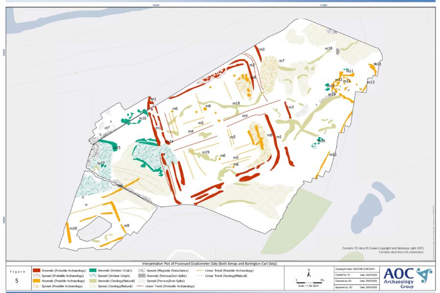
The road crossing the fort showed clearly in the survey data, and a range of anomalies suggest the presence of features including stone-built walls. A possible annex to the west of the fort, previously identified in aerial photographs, was revealed in more detail, as were buildings to the east. Perhaps the most revealing result of the geophysical survey was the additional detail on the form of the defences, depicted in previous plans as a single rampart and ditch. However, the geophysical survey data suggests the presence of two or three concentric ramparts.
This phase of geophysical survey adds to what is known about the site, providing important additional detail about the form and nature of the fort’s defences as well as its internal and external buildings and other structures.
Read AOC’s full report on geophysical survey at Easter Happrew (5MB)
Further reading:
Steer, K. (1959). The Roman Fort at Easter Happrew, Peeblesshire in Proceedings of the Society of Antiquaries of Scotland, Vol. 90, pg. 93-101.