Archives
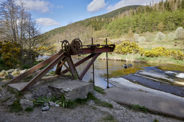
Industrial Tweed
The Tweed and its landscapes have a rich industrial history, from early modern times to the 20th century. This strand of Uncovering the Tweed aims to highlight key industries and their impact on the region. Medieval watermills, used for grinding grain and other purposes, mark the earliest industrial activity along the Tweed. Remnants of these […]
Excavations at Horndean
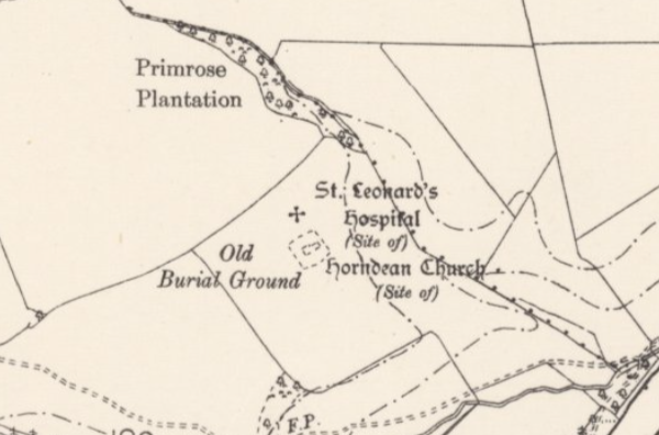
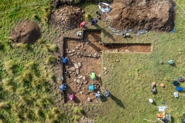
Excavations at the site of a supposed deserted medieval village near Horndean in July 2024 have revealed exciting new discoveries about life on the Tweed in the medieval period. Around 700m east of the current village of Horndean lie the remains of a medieval church. While traces of the church are visible above the ground, […]
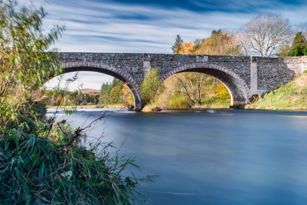
Crossing the Tweed
This sub-theme of Mapping the Tweed seeks to explore and record crossing places of the Tweed river and associated tributaries. Crossing points offer the opportunity to map communication routes through the landscape, and the ways these have changed through time in response to political, economic and environmental changes. Several of these may be extant bridges […]
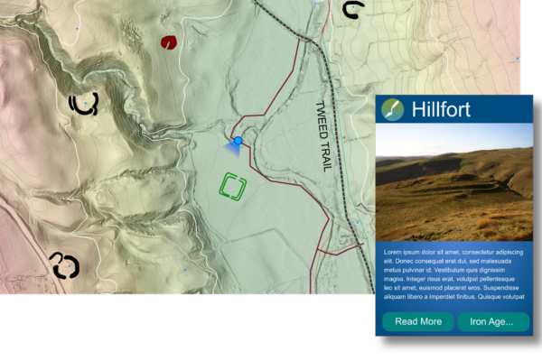
Mapping the Tweed
Mapping the Tweed is a sub-project at the core of the Uncovering the Tweed project. Using the aerial LiDAR data available for the project area, the archaeological mapping programme will create new content that can be used to present and promote the archaeology of the River Tweed Trail. The mapping programme will introduce participants to […]
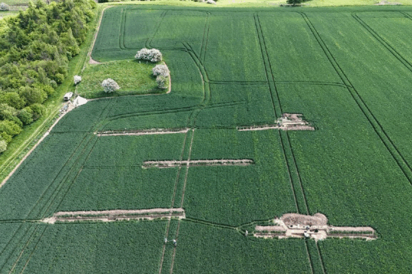
Exploring the Medieval
Evidence of life along the river in the Medieval period is in no short supply, ranging from massive castles and abbeys that dominate the landscape to lost villages known only from historic maps. Uncovering the Tweed has explored evidence for deserted villages including the supposed settlement and hospital adjacent to the site of Horndean Church […]
Excavations at Adie’s Brae
Excavations at a scooped settlement north of Moffat in October 2024 have helped shed light on life in Southern Scotland in prehistory. The landscape around Ericstane and Corehead, north of Moffat contains some very visible traces of the late prehistoric period, and represents a very good example of how prehistoric archaeology can survive around the […]