Online Uncovering the Tweed Workshop
Join AOC Archaeology Group for this remote workshop to introduce you to LiDAR and how we can use this technology to identify and investigate archaeology in the landscape.
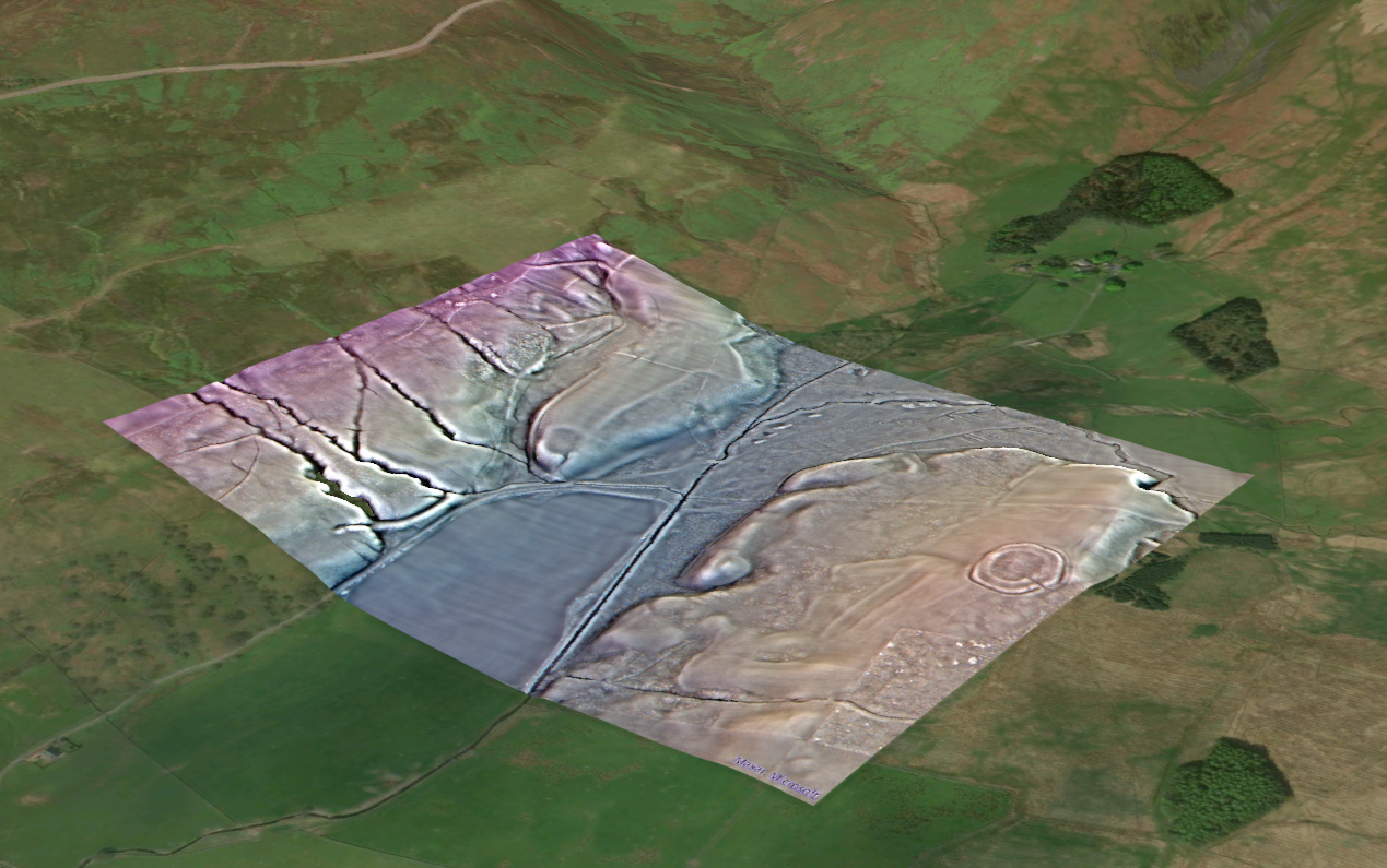
LiDAR (‘Light Detection and Ranging’) has revolutionised field survey of archaeological sites and monuments. The technique involves using high-resolution laser scanning from aircraft to map terrain, and the products can be used to make very detailed topographic maps of the ground surface, meaning that even very faint traces of past activity can be detected.
In south-east Scotland and north Northumberland, we have very good LiDAR coverage and the data is freely available to the public. In this workshop we will learn about how LiDAR works, how to interpret the imagery it creates and how to go about mapping archaeology. Uncovering the Tweed provides a web map for viewing the LiDAR data for the Tweed valley alongside existing records, allowing us to plot new features where they appear.
We will cover:
- An introduction to LiDAR and how it works
- Where to find LiDAR data and how to use the UtT archaeology web mapper
- How to interpret LiDAR imagery
- What is archaeology? How do we know when we see it?
- Working with historic environment records and historic maps
- Planning field survey and ground inspection
- Creating good records.
Participation is free but please book your tickets via: Uncovering the Tweed LiDAR Workshop (Online) Tickets, Tue 24 Sep 2024 at 19:00 | Eventbrite
Teams meeting details will be emailed out in due course.
This event is being delivered in association with Peeblesshire Archaeological Society, but non-members are very welcome!
Events
-
Join Connecting Threads for a flying fish flag puppet-making workshop, procession & optional community swim in celebration of the River ...
-
Riverwoods, Destination Tweed’s Tweed Stories and Innerleithen Community Trust invite you to a drop-in creative storytelling and story-gathering event exploring the River Tweed and ...
-
FULLY BOOKED Join AOC Archaeology Group as they return to the newly discovered medieval moated site on the banks of ...